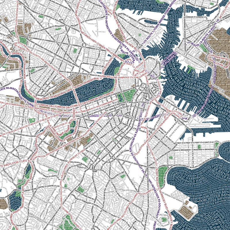
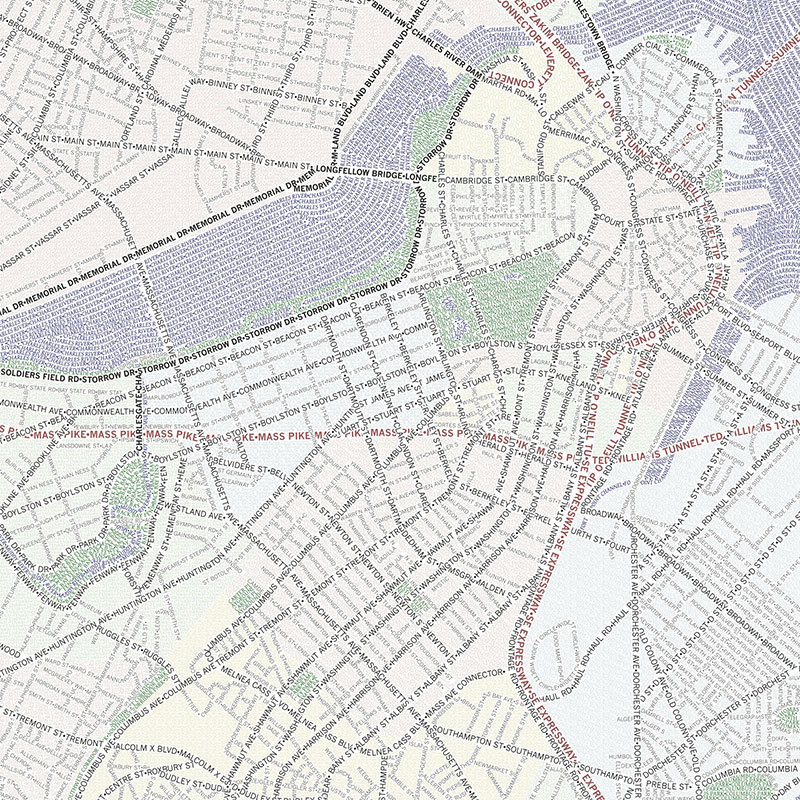
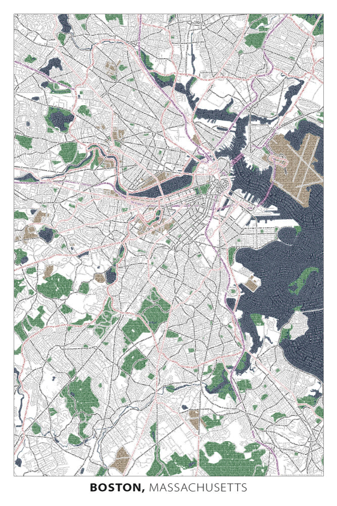
It's been five years since we first introduced our map of Boston. The popularity of that map started us down a course of typographic mapping that has since expanded to 11 cities. Given the special place that Boston has in our hearts, we felt it was well deserving of a redesign. And to prove just how much we love this city, we started from scratch. In other words, we started at the beginning with a blank canvas, imported a fresh copy of Open Street Map geography and place names, determined a new map extent and layout, and chose new fonts, colors, and character styles. The new Boston, 2nd edition poster is still 24 inches wide by 36 inches tall, but looks and feels dramatically different.
 Boston 2nd ed. typographic map
Here are some of the most notable changes:
Extent and Map Scale
The 2nd edition covers a much larger area than the original version. We now include the entire city of Boston, plus a number of surrounding towns. Cambridge and Somerville are still present, of course, but we now extend farther north into Medford and Malden. The extension southward is even greater, covering the area all the way down to Dedham, Milton, and the Blue Hills Reservation.
Fitting more territory on the same-sized poster meant a smaller scale map, which in turn called for some design modifications. For example, because streets were crunched closer together at the new scale we reduced font sizes. The smallest text on the map is that of residential streets -- now just 6pt in size. It's still readable yet small enough to prevent excessive overlap in the denser parts of the city. We also removed the underlying neighborhoods layer that existed in the original version. Again, due to the smaller scale, it cluttered the map and was mostly buried by streets anyway.
Area Features
One of the most visually striking design changes was to the area features on the map, including water, parks and "institutions" (a catch all for universities, airports, or other important not-green areas). Solid color fills behind reversed-out white text gives them a bolder look, compared to the original map. Also, the high contrast between these areas and the white map background gives the map more definition overall and makes some features like small parks, narrow rivers, and jetties, easier to see. Achieving strong figure-ground contrast between land and other area features has always been a challenge with typographic mapping because there is only so much ink that a letter can hold. This method of treating areas with solid background fills seems to help the map visually and functionally while staying true to our aim of covering everything with text.
There are a couple of smaller changes worth noting, too:
Wavy water text
We've liked the wavy water text style ever since we first applied it to the Chicago map. Variation in text size, placement along curving paths that parallel one another, and the use of opacity masking to give the appearance of overlapping waves all come together to represent the flow and movement of water better than any other technique we know. We hope the redesigned water text in the 2nd edition map does the same.
Tunnels
Boston is famous for its major underground and underwater tunnels. The 2nd edition Boston map is the first to employ a text style specifically for tunnels. Where highway text goes subsurface, we simply reverse its fill and stroke color. For example, Interstate 90 is represented by purple text with a white stroke but where it becomes Ted Williams Tunnel it is reversed and becomes white text with a purple stroke. I can't help but compare the bright white tunnel text to the bright lights of cars being turned on as they go beneath the surface.
Below are images of the two maps side by side, each covering an area that is approximately 13 by 13 inches on the printed poster. The 2nd ed. covers a lot more ground in the same amount of space, has a bolder look due in part to its color-filled areas, has wavy water text, and a couple of new headlight-style tunnels. Let's say goodbye to the original Boston map and hello to the 2nd edition!